Map View
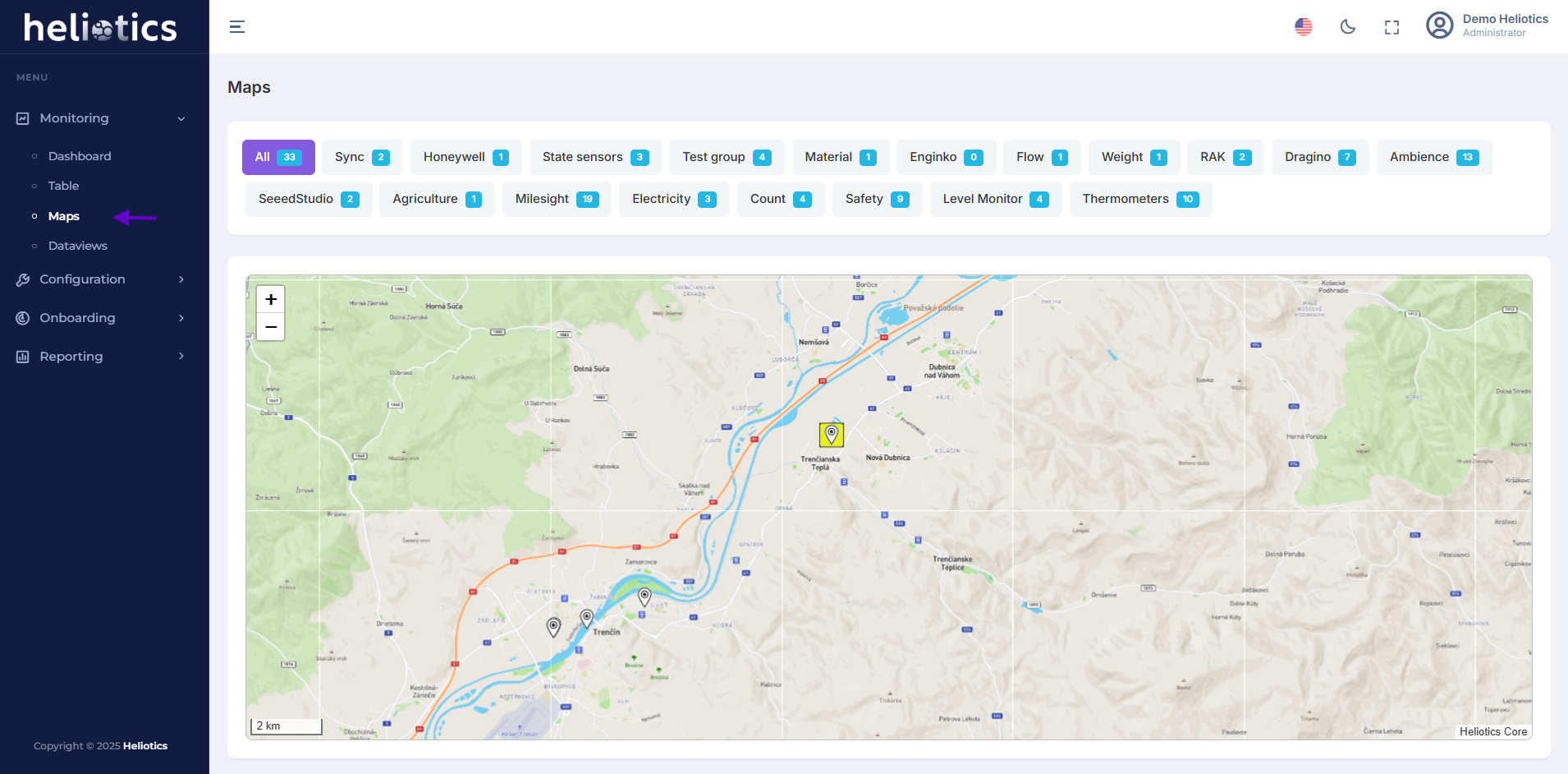
The Map View provides a geographical representation of all onboarded sensors, allowing users to monitor their location, data and performance at a glance
Features of Map View
-
Sensor Mapping: Display all sensors on an interactive map based on their location
-
Filter Options: Users can filter the displayed sensors based on their assigned groups
-
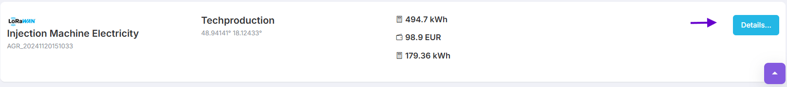
Sensor Data Summary: Summary section below the map provides key metrics for selected sensor, this includes: energy consumption, cost estimation, additional parameters depending on the sensor type
-
Quick Access to Details: Details button allows users to dive deeper into specific sensor data